
About
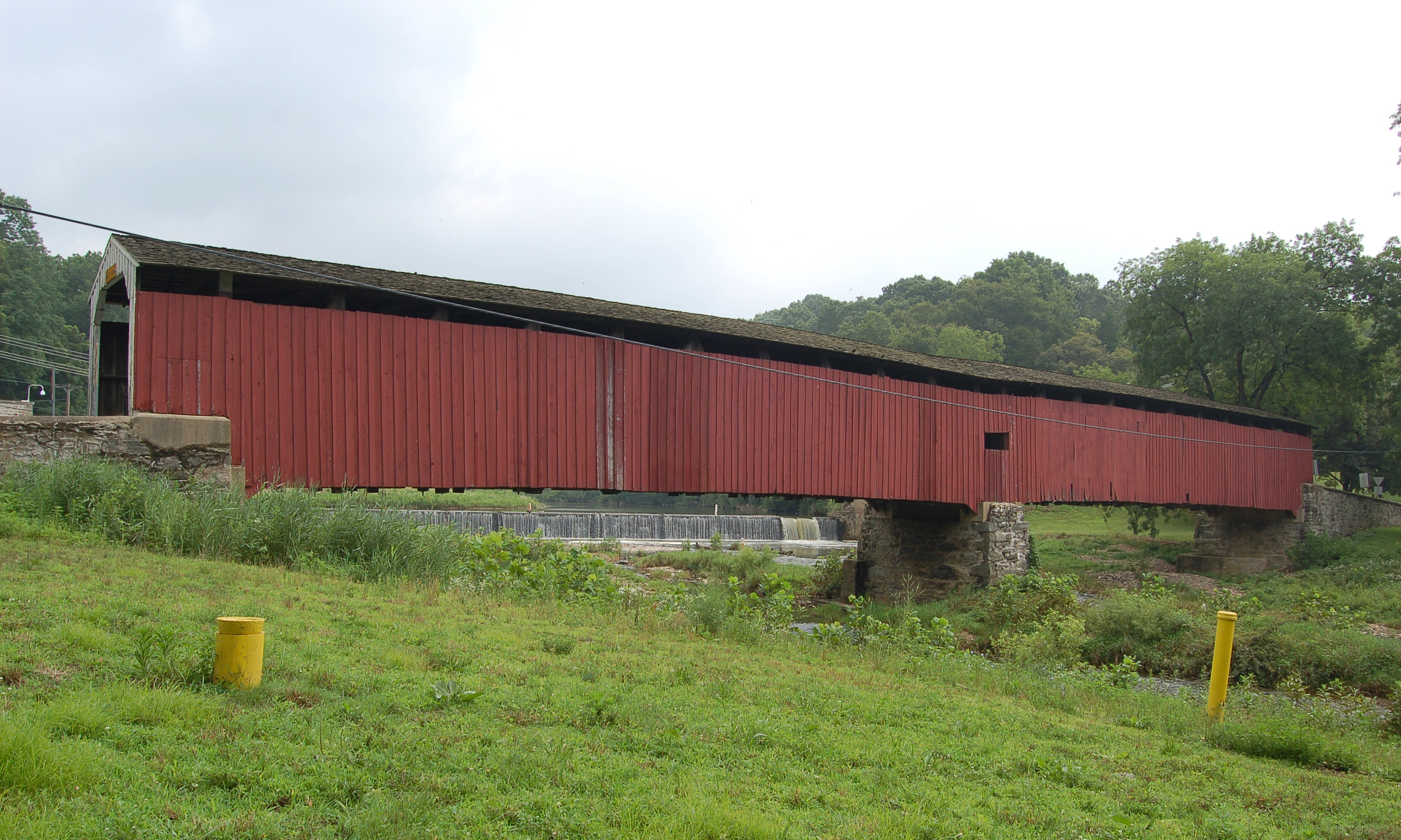
White Rock Forge Covered Bridge carries White Rock Road over the West Branch of Octoraro Creek south of Kirkwood, in southeast Lancaster County. It stands on the line between Little Britain and Colerain townships. The single span Burr arch truss bridge is 103 ft long and 13 ft wide, and its official designation is West Octoraro #2 Bridge. It is county owned and open to traffic.
History
In 1845 residents of Little Britain and Colerain townships petitioned for a bridge on the road from Oak Hill to Union Meeting House, and the first bridge was completed in the winter of 1847. Wikipedia gives its builder as John Russell; the roadside marker names Joseph Russell. That bridge was swept away in a June 1858 storm. Heavy rain that began on June 25, 1884 sent Octoraro Creek higher than ever known and swept the bridge at White Rock Forge away again. Neighbors built a temporary crossing from timbers of the old bridge for 47 cents, the cost of the nails, and Elias McMellen rebuilt the bridge in the weeks that followed. The marker gives the cost as $2,495; coveredbridges.earthlyphotos.com gives $2,167. The bridge was listed on the National Register of Historic Places on December 10, 1980, and is described as the county's second oldest covered bridge still in service.
Design
The bridge is a single span double Burr arch truss with added steel hanger rods. It has an oak plank deck and is painted red inside and out, the traditional color of Lancaster County covered bridges, with white approaches. The span is 103 ft; one source gives 110 ft overall.
Visiting
The bridge is on White Rock Road, about 0.1 mile east of King Pen Road. It carries one lane of vehicle traffic.
Sources: Wikipedia: White Rock Forge Covered Bridge, HMdb: White Rock Forge Covered Bridge marker, Covered Bridges: White Rock Forge
Photo: Derek Ramsey (Ram-Man), CC BY-SA 2.5, via Wikimedia Commons.
Similar Bridges in category
Explore More
Hunsecker's Mill Covered Bridge
Manheim and Upper Leacock townships, Lancaster County. Built 1843, 180 ft over the Conestoga River. The county's longest single-span covered bridge, rebuilt in 1973 after Agnes.

Herr's Mill Covered Bridge
Elizabethtown, Lancaster County. Built 1844, a two-span 178 ft bridge over Pequea Creek. Dismantled in 2018 and moved to the private Stone Gables Estate.
Pine Grove Covered Bridge
Little Britain Township, Lancaster County. Built 1884, 198 ft over the East Branch Octoraro Creek. A two-span Burr arch, it is the county's longest covered bridge.