
About
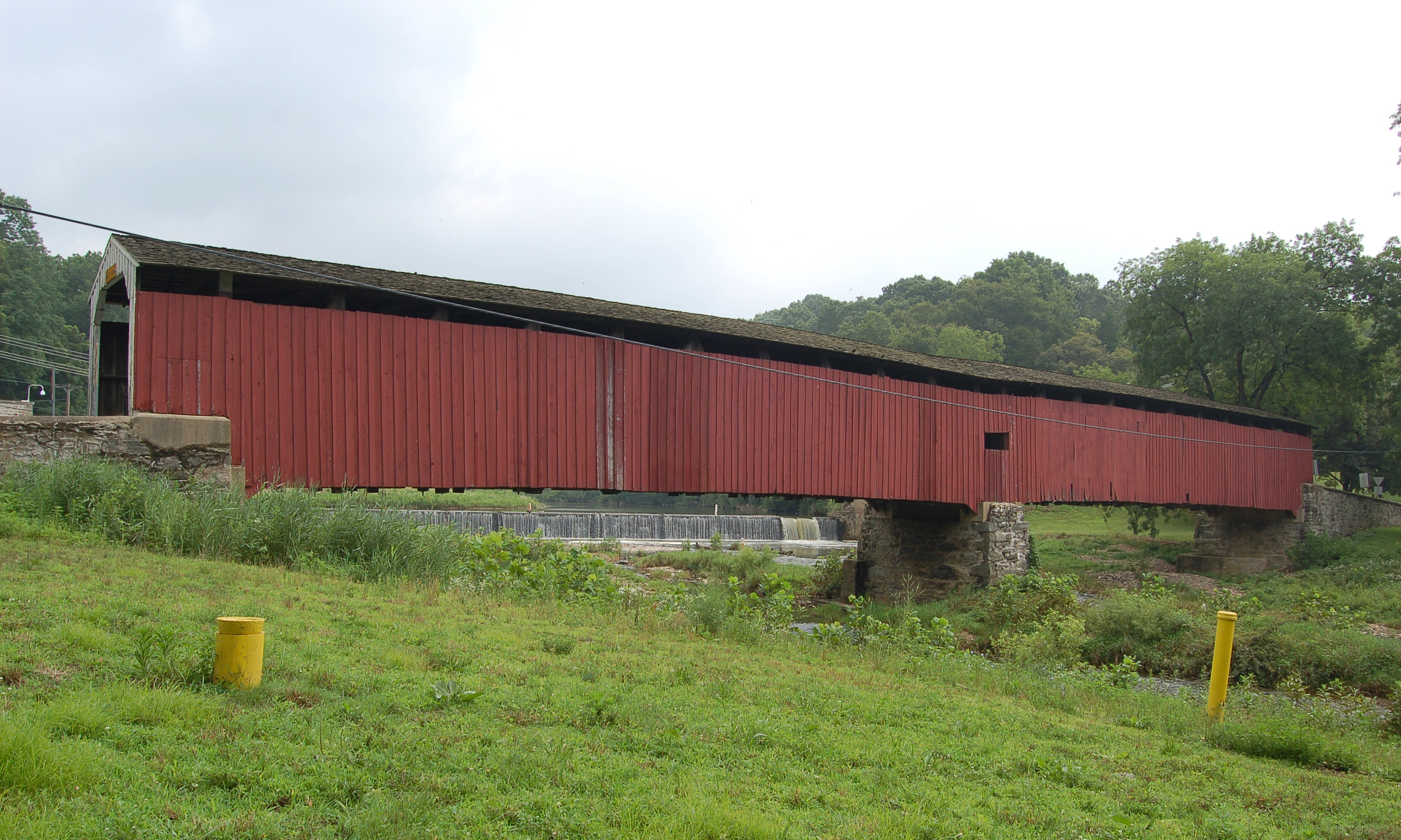
Hillsgrove Covered Bridge carries Covered Bridge Road (Township Road 357) over Loyalsock Creek in Hillsgrove Township, Sullivan County, about a quarter mile off Route 87. Built in 1850, it is a Burr arch truss bridge and the longest of the county's three remaining covered bridges. It is open to traffic. It is also known as Rinkers Covered Bridge, after the adjoining Rinker farm.
History
Sadler Rodgers (also spelled Rogers), a Forksville native then about 18, built the bridge in 1850, the same year he built the Forksville Covered Bridge to a similar design. It survived the floods of March 1865 and June 1889, which destroyed other bridges in the West Branch Susquehanna valley. From about 1870 to 1890 lumber rafts landed at the site, known as Uncle Ben's Landing. National Bridge Inventory data records a reconstruction in 1963, and T. Corbin Lewis restored it in 1968. It was listed on the National Register of Historic Places on July 2, 1973, the first covered bridge in Sullivan County to be listed, and was included in a 1980 multiple property submission for covered bridges in Bradford, Sullivan and Lycoming counties. A 2010 rehabilitation replaced the metal roof with cedar shakes and painted the bridge red. Flooding from Hurricane Irene and Tropical Storm Lee in 2011 stripped siding, washed out the approaches and damaged structural beams. The repaired bridge reopened on November 21, 2012.
Design
The bridge uses a Burr arch truss, with arches set alongside multiple kingposts on each side. Its 19th century regulations on speed, animals and fire are still posted on the bridge. Sources disagree on its length: 186 ft (Wikipedia, coveredbridges.net), 185 ft 8 in (Evans, 2001), 171 ft (1980 NRHP) and 152 ft (Zacher, 1994). The 2012 National Bridge Inventory gave a 12 ft 2 in roadway, enough for one lane.
Visiting
The bridge is on Covered Bridge Road near Loyalsock State Forest and can be driven across one lane at a time, with an 8 ft posted clearance. Parking is limited by private property signs, though there is a small pull-off on the far side of the bridge.
Sources: Wikipedia: Hillsgrove Covered Bridge, Covered Bridges: Hillsgrove, Uncovering PA: Covered Bridges of Sullivan County
Photo: Ruhrfisch, CC BY-SA 4.0, via Wikimedia Commons.
Similar Bridges in category
Explore More
Hunsecker's Mill Covered Bridge
Manheim and Upper Leacock townships, Lancaster County. Built 1843, 180 ft over the Conestoga River. The county's longest single-span covered bridge, rebuilt in 1973 after Agnes.

Herr's Mill Covered Bridge
Elizabethtown, Lancaster County. Built 1844, a two-span 178 ft bridge over Pequea Creek. Dismantled in 2018 and moved to the private Stone Gables Estate.
Pine Grove Covered Bridge
Little Britain Township, Lancaster County. Built 1884, 198 ft over the East Branch Octoraro Creek. A two-span Burr arch, it is the county's longest covered bridge.