
About
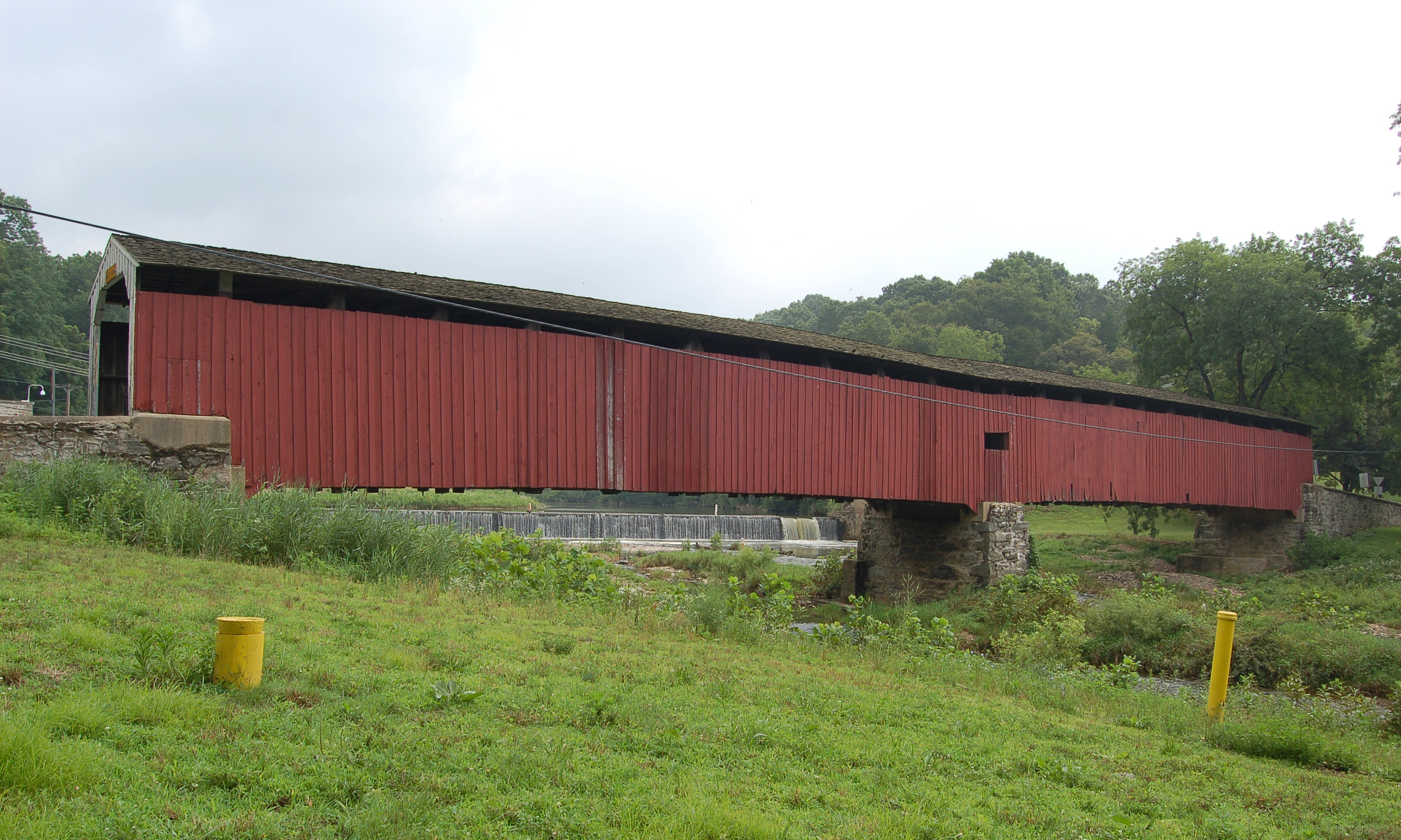
Sachs Covered Bridge, also known as Sauck's or Waterworks Covered Bridge, carries Waterworks Road over Marsh Creek southwest of Gettysburg, on the line between Cumberland and Freedom Townships in Adams County. It is a 100 foot Town lattice truss bridge built in 1854. It has been closed to vehicles since 1968 and is open to pedestrians.
History
David S. Stoner built the bridge around 1854 at a cost of $1,544. During the Battle of Gettysburg it was called the Sauches Covered Bridge. On July 1, 1863, two brigades of the Union I Corps crossed it toward Gettysburg and the III Corps crossed it toward the Black Horse Tavern, and four days later most of Lee's Army of Northern Virginia retreated over it. In 1938 the Pennsylvania Department of Highways named it the state's "most historic bridge." Cumberland Township officials closed it to vehicles on May 9, 1968, while keeping it open to pedestrians. It was listed on the National Register of Historic Places on August 25, 1980. A flash flood on June 19, 1996, knocked the bridge off one of its abutments while a restoration was already under way. It was repaired and rededicated on July 21, 1997.
Design
The Town lattice truss, designed by Connecticut architect Ithiel Town, uses a web of crisscrossing planks in place of heavy posts and braces. The 1980 nomination notes that this is the only Town truss among the covered bridges of Adams, Cumberland and Perry counties. Wikipedia gives its width as 15 feet 4 inches.
Visiting
The bridge stands at the end of a short dirt road off Pumping Station Road, in the southwestern corner of Gettysburg National Military Park. Uncovering PA notes a dirt lot with room for a handful of cars. The bridge is open to pedestrians only.
Sources: Sachs Covered Bridge, Wikipedia, Covered Bridges of Adams County, Uncovering PA, Covered Bridges of Adams, Cumberland and Perry Counties, NRHP nomination
Photo: Gdschermer, CC BY-SA 4.0, via Wikimedia Commons.
Similar Bridges in category
Explore More
Hunsecker's Mill Covered Bridge
Manheim and Upper Leacock townships, Lancaster County. Built 1843, 180 ft over the Conestoga River. The county's longest single-span covered bridge, rebuilt in 1973 after Agnes.

Herr's Mill Covered Bridge
Elizabethtown, Lancaster County. Built 1844, a two-span 178 ft bridge over Pequea Creek. Dismantled in 2018 and moved to the private Stone Gables Estate.
Pine Grove Covered Bridge
Little Britain Township, Lancaster County. Built 1884, 198 ft over the East Branch Octoraro Creek. A two-span Burr arch, it is the county's longest covered bridge.