
Lancaster County, Warwick Township. Built 1843, rebuilt 1973. 180 ft long. Lancaster County's longest single-span covered bridge, open to traffic.
The only remaining covered bridge crossing any branch of the Susquehanna River and the last covered bridge in Clearfield County, built for just $175 in 1873.
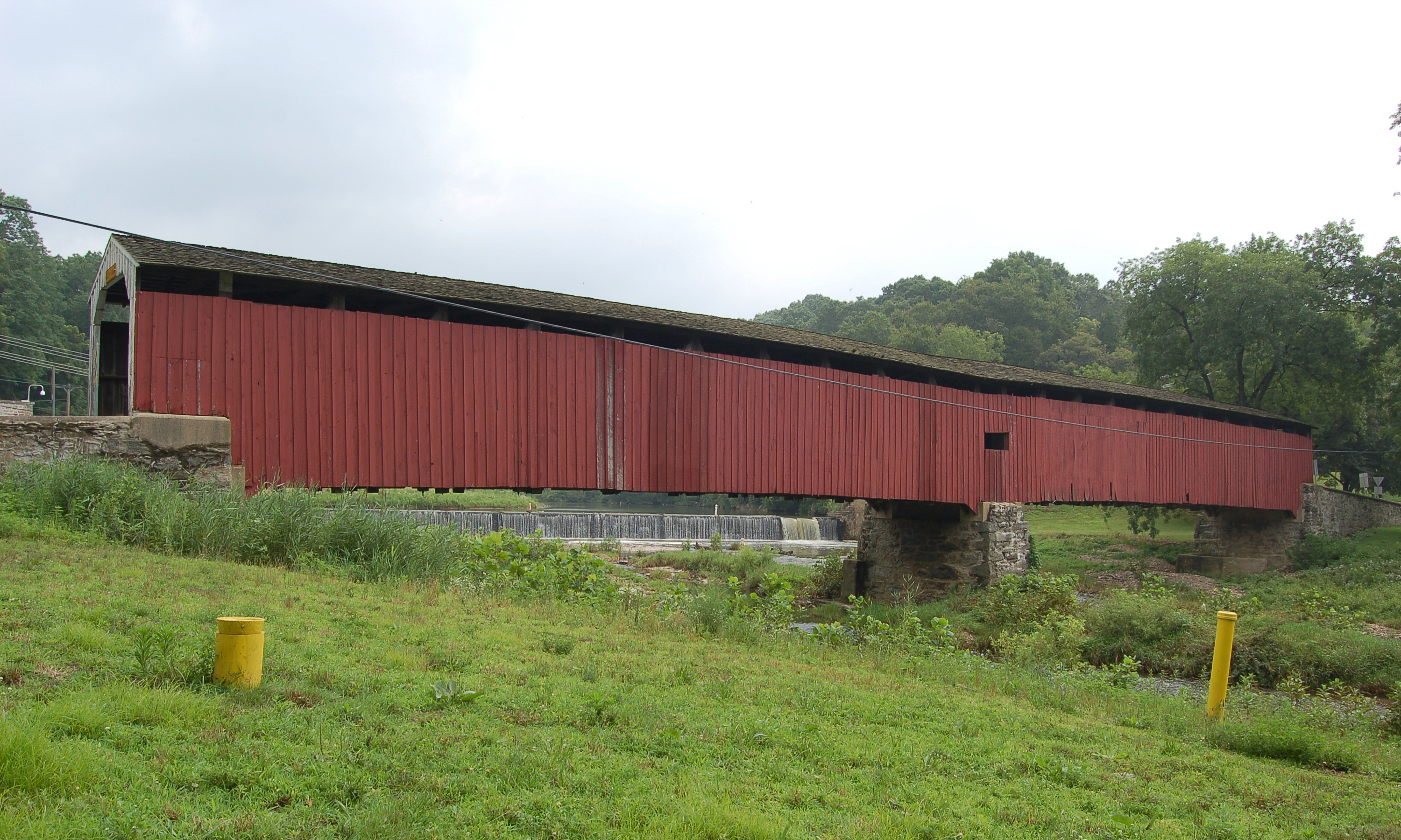
McGees Mills Covered Bridge is a historic landmark holding two significant distinctions: it is the only remaining covered bridge crossing any branch of the Susquehanna River, and it is the last covered bridge in Clearfield County. Built in 1873 by Thomas McGee, this 109-foot Burr Arch Truss bridge spans the West Branch of the Susquehanna River near the small borough of Mahaffey. The bridge witnessed the great era of lumber rafting, with thousands of timber rafts passing beneath it, including the ceremonial "Last Raft" in 1938.
Thomas A. McGee received an appropriation of $1,500 from the Clearfield County Commissioners to construct a replacement for a bridge destroyed by winter flooding in 1872-1873. Remarkably, McGee built this substantial single-span bridge using only $175 worth of locally hand-hewn white pine timbers. It was the last covered bridge built in Clearfield County. The bridge witnessed the peak and decline of the lumber industry, as thousands of rafts loaded with timber floated the West Branch of the Susquehanna River beneath its span. In 1938, as a farewell to the old lumber industry, a ceremonial "Last Raft" passed under the bridge. The bridge was listed on the National Register of Historic Places in 1980 (some sources say 1988). On March 14, 1994, record-breaking ice and snow caused the bridge to collapse, leading to an extensive restoration completed in 1994-1995 by the Pennsylvania Conservation Corps.
McGees Mills Covered Bridge features a single-span Burr Arch Truss design measuring approximately 109-122 feet (sources vary). Following the 1994 collapse, the bridge was extensively reinforced with heavy steel mending plates at the joints of the Burr arches, angle irons and mending plates on other wooden timbers, and a five-foot-high wall of laminated planks banded with steel plates running the entire length of the bridge interior. This makes it one of the most extensively reinforced covered bridges in Pennsylvania. While the interior reinforcement is substantial, it is not visible from outside, preserving the bridge's historic appearance.
McGees Mills Covered Bridge is located near Mahaffey in southwestern Clearfield County, just off the busy Route 219. Despite its proximity to a major highway, the bridge is roughly 20 minutes from Punxsutawney and 40 minutes from Interstate 80. Coordinates are 40.880000, -78.765237. Large pull-offs exist on both sides of the bridge, and a picnic grove adjacent to the bridge allows visitors to enjoy the scenic setting along the Susquehanna River. The fishing in the area is reportedly excellent. The bridge marks the beginning (or end) of the West Branch Susquehanna Byway, a scenic driving route through Clearfield County. Nearby attractions include the Coalport Area Coal Museum and Bilger's Rocks.
Lancaster County, Warwick Township. Built 1843, rebuilt 1973. 180 ft long. Lancaster County's longest single-span covered bridge, open to traffic.

Lancaster County, Leacock/Paradisehttps://directify.app/app/2294/projects/10553608/edit Townships. Built 1844. 178 ft long. One of 12 double-span, double-arch covered bridges in USA, pedestrian access only.
Lancaster/Chester County Line. Built 1864. 198 ft long. Lancaster County's longest covered bridge, Civil War era construction, open to traffic.