
About
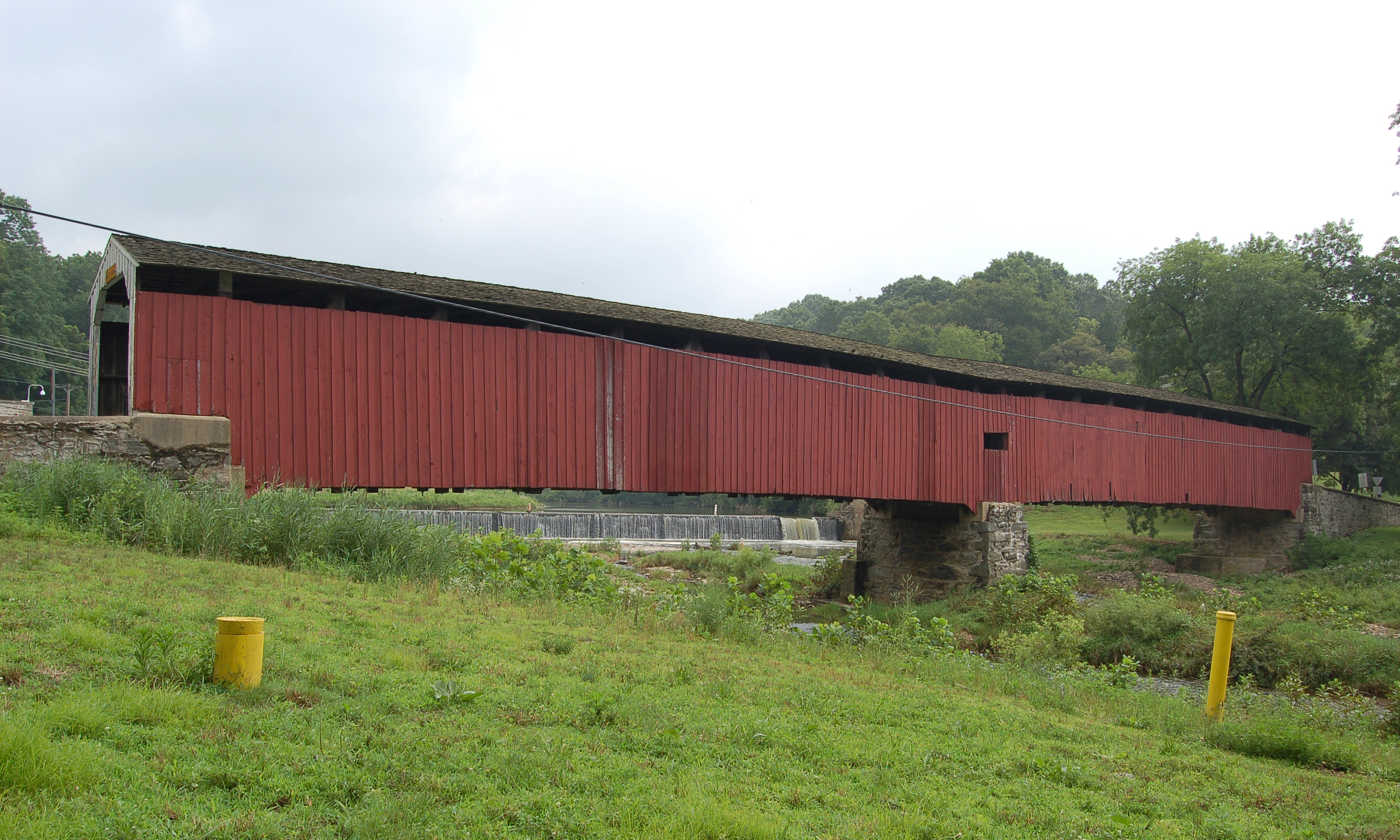
Kurtz's Mill Covered Bridge spans Mill Creek, a tributary of the Conestoga River, inside Lancaster County Central Park in Lancaster. It is a single span built in 1876; Wikipedia and the county guide give 94 ft, while other sources give 90 ft. The county lists it as Mill #2A Bridge on Kiwanis Road, and it carries road traffic within the park.
History
W. W. Upp built the bridge in 1876 over the Conestoga River. It was known as Isaac Baer's Mill Bridge, among other names. In June 1972 floodwaters from Hurricane Agnes damaged it. David Esh repaired it in 1975 and moved it to its present site in the park. Unlike most of the county's covered bridges, it is not listed on the National Register of Historic Places. Lancaster County owns and maintains it.
Design
The bridge uses double Burr arch trusses, a timber arch on each side combined with a multiple kingpost truss, with steel hanger rods added. The deck is oak plank and the clear deck is 11 ft 8 in wide. It is painted red inside and out, and the approaches are red with white trim. A metal plaque on the bridge describes its history.
Visiting
The bridge is reached by Kiwanis Road inside Lancaster County Central Park, and vehicles can drive across it.
Sources: Wikipedia: Kurtz's Mill Covered Bridge, Lancaster County Covered Bridges guide (2021), Lancaster County: Covered Bridges
Similar Bridges in category
Explore More
Hunsecker's Mill Covered Bridge
Manheim and Upper Leacock townships, Lancaster County. Built 1843, 180 ft over the Conestoga River. The county's longest single-span covered bridge, rebuilt in 1973 after Agnes.

Herr's Mill Covered Bridge
Elizabethtown, Lancaster County. Built 1844, a two-span 178 ft bridge over Pequea Creek. Dismantled in 2018 and moved to the private Stone Gables Estate.
Pine Grove Covered Bridge
Little Britain Township, Lancaster County. Built 1884, 198 ft over the East Branch Octoraro Creek. A two-span Burr arch, it is the county's longest covered bridge.